

Crawley Hill [Hetty Pegler's Tump]
Good walks are even better shared.
ST7899 : Field and Coaley Wood south of Hetty Pegler's Tump
David Smith Photo source
Overview
Crawley Hill [Hetty Pegler's Tump]
Crawley Hill, affectionately known as Hetty Pegler's Tump, is nestled in the heart of the picturesque Cotswolds. Standing at an elevation of 217 meters, it offers a unique blend of natural beauty and cultural history.
Geology
The charm of Crawley Hill is rooted in its limestone composition, which contributes not just to its scenic views but also to the rich biodiversity in the vicinity. The distinctive terraced appearance is a testament to the erosive forces that shaped this landscape over millennia. Don’t be surprised to spot a few curious locals – the wildflowers in spring are known to hang around for a chat!
Access and Parking
Accessing Crawley Hill is relatively straightforward. The nearest parking is available in Bredon, where you'll find several lay-bys and a small car park. A delightful 2 km stroll from the village will ease you into your hiking adventure, so don’t forget to stretch those legs!
Public transport options are also at play - regular bus services operate to and from Bredon. However, it’s always wise to double-check the current timetables; you wouldn’t want to be waiting longer than necessary for a bus that’s playing hard to get.
Routes
The Crawley Hill Circular Walk is a highlight for many visitors, covering about 6.5 km and taking approximately 2.5 hours. This route is a moderate trek, full of the stunning sights that the Cotswolds are famous for, weaving through delightful woodlands. This is where ancient history meets modern-day adventure!
Summit Features
At the summit, you’ll find a historic trig point and a charming stone cairn. Perfect for that sponsored summit selfie or a moment of personal triumph, it’s also a fitting tribute to whispers of the past – good old Hetty would likely have given her blessing!
Views and Terrain
Once you reach the summit, prepare to be awed by views stretching across the Severn Valley and, on particularly clear days, even down to the Malvern Hills. For the best views, spring and autumn present nature at its finest, while the early and late hours of the day offer dramatic light cast over the landscape.
The terrain is primarily grassy with the occasional cheeky rocky patch or boggy spot – watch your step after rain and embrace the mud as part of the experience!
Nearby Summits
Bredon Hill, with its height of 399 meters, is a nearby gem just waiting to complement your adventure at Crawley Hill. Why not consider a dual-summit challenge?
Facilities
Post-hike, you can reward yourself at one of Bredon’s welcoming pubs or cafes, which provide both refreshments and necessary toilet facilities. Just don’t mention any embarrassing slip-ups on the trail – leave the stories to us.
History
The whimsical name ‘Hetty Pegler’s Tump’ certainly raises eyebrows and piques interest! The spectacle of this hill is enhanced by the historical narratives attached to it, making your hike a splendid mix of leisure and learning.
So lace up those hiking boots and prepare for an engaging adventure; Crawley Hill awaits with open arms (and possibly a few sheep). Happy hiking!
Explore routes near Crawley Hill [Hetty Pegler's Tump]
Walks starting near this hill. Open a route to check its map, distance and full itinerary.
Woodchester Park: Tinkley Gate, lakes and Mansion woodland walk
View route
Forest of Dean Full Colliers Trail from Cannop Ponds
View route
Forest of Dean Hicksters Way Woodland Circuit from Cannop
View route
Cirencester Walk with Men Walking & Talking
View route
Route planning notes
These notes describe possible approaches. Check a route's map and access information when planning your walk.
Crawley Hill Circular Walk
A beautiful circular route starting from the nearby village of Bredon, taking you through scenic woodlands and past historical landmarks.
Make a day of it, together
Find someone to share the walk with, or organise a day out along a route you like.
Photo Gallery
View all Photo could not load
ST7899 : Field and Coaley Wood south of Hetty Pegler's Tump
David Smith
 Photo could not load
SO7800 : The Cotswold Way in Coaley Wood
Bill Boaden
 Photo could not load
SO7800 : Fallen tree in Coaley Wood
Bill Boaden
 Photo could not load
SO7800 : The Cotswold Way at Coaley Wood
Ian S
 Photo could not load
SO7800 : Diverging paths in Coaley Wood
Bill Boaden
 Photo could not load
SO7800 : Cotswold Way traversing steep slope
don cload
 Photo could not load
SO7800 : The Cotswold Way through Coaley Wood
Tim Heaton
 Photo could not load
SO7800 : Walkers in Coaley Wood
Ian S
 Photo could not load
SO7800 : East entrance of Hetty Pegler's Barrow
C Michael Hogan

SO7800 : Hetty Pegler's Tump
Michael Murray
Hill facts and local notes
Classifications
Elevation
251m
824 ft
Prominence
98m
Coordinates
51.6986, -2.3059
SO789000
OS Map
162
Explorer: 167 168
At the Summit
The summit features a historic trig point and a modest stone cairn, both of which serve as perfect photo opportunities. Good old Hetty Pegler would be proud!
Terrain & Geology
Crawley Hill consists primarily of limestone, typical of the Cotswold region, which has contributed to its distinct terraced appearance and rich calcareous soils, supporting diverse flora.
Views & Scenery
From the summit, one can see the Severn Valley, Bredon Hill, and on a clear day, the Malvern Hills in the distance.
History & Heritage
Name Origin
The name 'Hetty Pegler's Tump' likely references a local legend or historical figure, adding a layer of whimsy to the hike.
Historical Significance
The hill is associated with local folklore and provides insight into the region's historical landscape and usage.
Getting There & Facilities
Parking
There are several lay-bys and a small car park in the village of Bredon, about 2 km from the trailhead.
Public Transport
Regular bus services connect Bredon with surrounding areas, but check timetables in advance!
Nearby Facilities
There are local pubs and cafes in Bredon offering refreshments and toilets, perfect for a post-hike treat.
Safety Information
Known Hazards
- Beware of muddy patches after rainfall and the potential for slippery rocks.
General Safety Tips
- Check weather conditions before setting out
- Carry appropriate clothing and equipment
- Let someone know your planned route
- Take a map, compass, and GPS device
- Carry emergency supplies: food, water, first aid kit, torch
Hills
Some common questions about the hills answered
Are there group walks up Crawley Hill [Hetty Pegler's Tump]?
Many walkers use Walkmates to join or organise walks with others. You can check for group walks around Crawley Hill [Hetty Pegler's Tump] through the maps
Are there other walkers around Crawley Hill [Hetty Pegler's Tump]?
Activity varies by location and time, but Walkmates lets you see whether others have shared walks or shown interest in this area. Find other people through the walking friends search walking friends for Crawley Hill [Hetty Pegler's Tump] search or of course create your own walk for Crawley Hill [Hetty Pegler's Tump]
Can I organise a walk to Crawley Hill [Hetty Pegler's Tump]?
Yes. If there aren’t any walks listed already, you can create a walk and make it available for others to join.
If you're signed up to Walkmates, you can create a walk to Crawley Hill [Hetty Pegler's Tump].
How do I find a walk up this hill?
There are often multiple ways to walk this hill, depending on experience and route preference. Walkmates helps you explore walks and routes that others have shared.
Can I suggest a new route up Crawley Hill [Hetty Pegler's Tump]?
Yes. You can suggest or create routes to share with others. Walkmates focuses on the social side of walking, so routes are used to help people organise walks and explore areas together, rather than as detailed navigation tools or route libraries.
Other uses really appreciate knowledgeable walkers sharing their routes. Share your favourite route to Crawley Hill [Hetty Pegler's Tump] here
The is an error or something incorrect about this hill. How do I let you know?
We always strive to keep the information on Walkmates as accurate as possible. If you find an error, please let us know through the contact form and we'll aim to correct it as quickly as possible
Community Discussion
Comments
Location
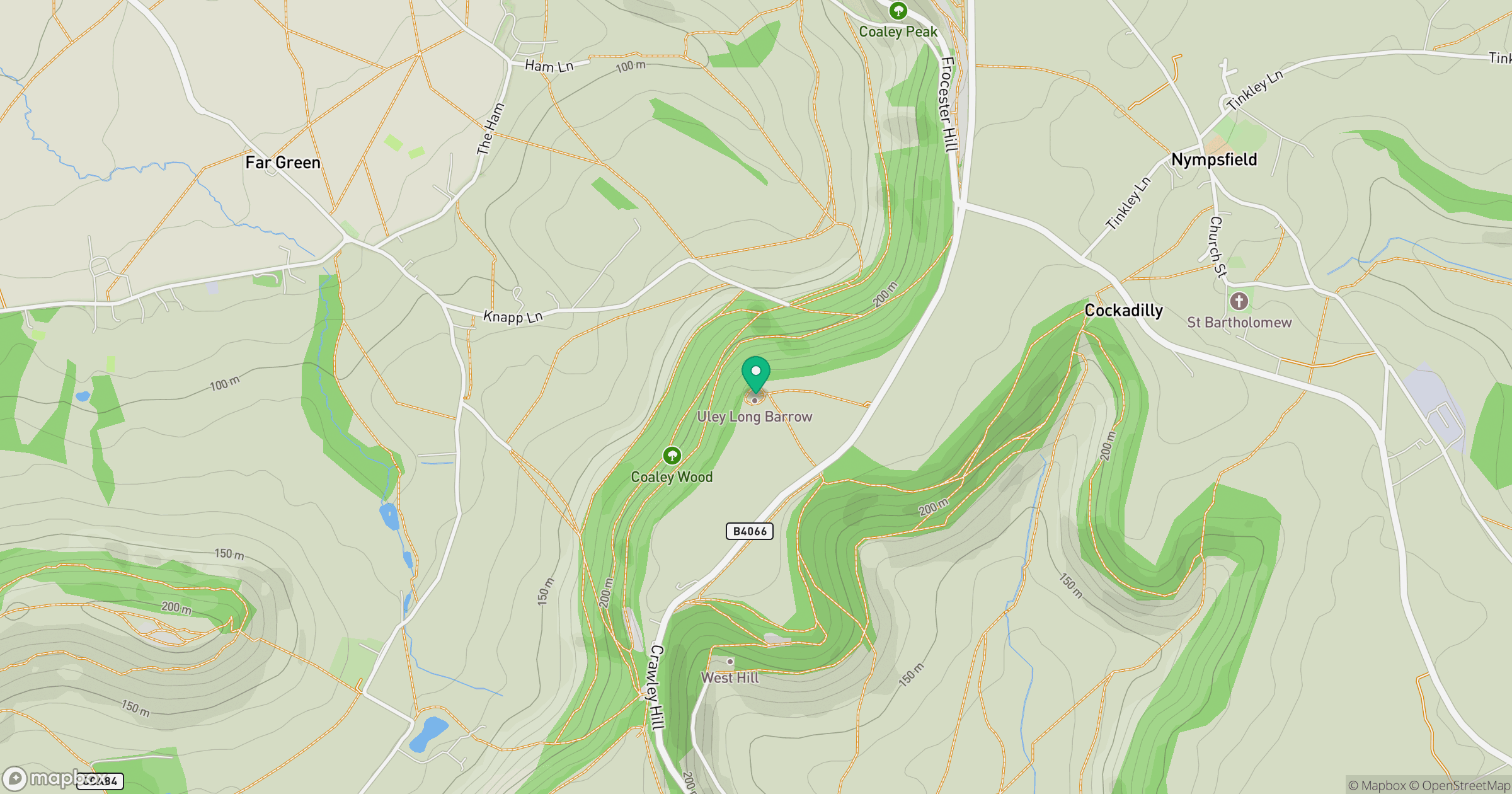
Grid reference: SO789000
View on OpenStreetMapOpens a map in a new tab, centred on the hill.
Nearby Hills
Worcestershire Beacon
425m
Glastonbury Tor
158m
Titterstone Clee Hill
533m
The Wrekin
407m
Long Mynd - Pole Bank
517m
No comments yet. Be the first.